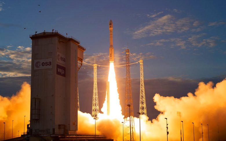
The European launch company Arianespace launched Aeolus, a weather satellite on 22nd August. Aeolus is the first satellite designed to measure Earth’s winds on a global scale. The satellite’s full name is Atmospheric Dynamics Mission Aeolus. Aeolus lifted off from the Guiana Space Center in Kourou, French Guiana at 5:20 p.m EDT (6:20 p.m local time, 2120 GMT).
The launch was a success as everything went according to the plan. Martin Kaspers, the product assurance manager for Aeolus described the launching event as, “All is fine on board. We saw Vega take off like a shot … rising like an arrow surprisingly fast.” Aeolus will be mapping the winds around the globe for the next three years. The European Space Agency (ESA) launched the Aeolus mission “to address the lack of global wind profiles in the Global Observing System”.
A description released by the World Meteorological Organization about the mission read, “Direct global profile measurements of wind fields are lacking, representing one of the largest deficiencies in the observing system and limiting improvements to numerical weather predictions and climate models.” Aeolus will measure winds around the globe from the surface of the Earth up into the stratosphere, to an altitude of 19 miles. Aeolus will definitely help with the weather forecasts around the world and the data that it will collect will help scientists understand climate change better and how it will impact the earth’s climate in the future. There is a wind mapping instrument present on the Aeolus and it is called “Aladin”.
For obvious reasons, it is extremely difficult to measure wind on a global scale. The ESA officials said, “The only way to achieve this is to probe the atmosphere from space using a highly sophisticated Doppler wind lidar”. Aladin will do the exact same job that they were worried about and looking for. Aladin works by blasting small laser pulses and collecting the light that scatters off particles in the atmosphere using a 5-foot (1.5 meters) telescope dish. The satellite will be able to determine wind altitude by measuring the time it takes the light from Aladin’s laser pulses to make the round-trip to and from a scattering particle. Measuring the change in the wavelength of the scattered light will help determine wind speed.
Aeolus will remain about 320 kilometers above the earth and it will pass over the equator twice every day at the same times: 12 a.m. and 12 p.m. EDT. Aeolus will spend only 20 minutes per day on the nighttime side of Earth. ESA scientists expect to hear the first signal from Aeolus today around 6:16 p.m. EDT (2216 GMT) via an ESA telescope at the New Norcia ground station in Australia. The mission was approved in 1999 and Aeolus was scheduled to launch in 2007 but many technological problems lead to 11 years of delays. The production of this satellite has cost ESA about $560 million according to IEEE Spectrum.
